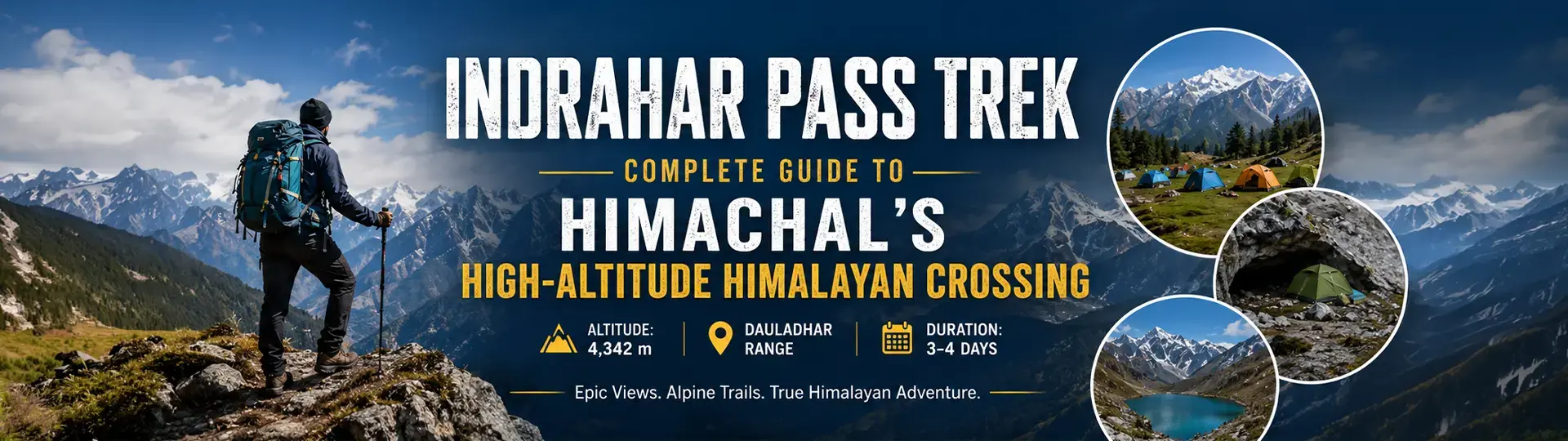
Indrahar Pass Trek: Complete Guide to Himachal's High-Altitude Himalayan Crossing
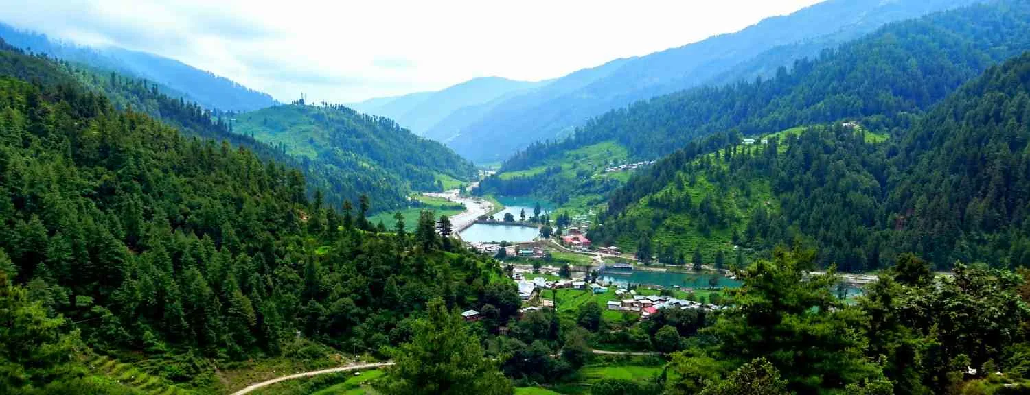
The Indrahar Pass Trek is one of the most rewarding high-altitude treks in Himachal Pradesh, climbing to roughly 4,342 metres (14,245 ft) across the rugged spine of the Dhauladhar Range above Dharamshala and McLeodganj. The trail forms a natural boundary between the Kangra and Chamba districts, rewarding trekkers with sweeping views of the Pir Panjal range, the Kangra Valley, and Lake Mankini on the descending side.

For trekkers who already know Triund, Indrahar Pass is the natural next step — a true Himalayan crossing rather than a day hike.
|
Author's Experience – Karandeep
|
Quick Facts: Indrahar Pass Trek Overview
|
Detail |
Information |
|
Altitude |
~4,342 m (14,245 ft) |
|
Starting Point |
McLeodganj, near Dharamshala |
|
Route |
McLeodganj → Triund → Lahesh Cave → Indrahar Pass |
|
Duration |
3–4 days (5 days if returning via Kuarsi/Bharmour) |
|
Difficulty |
Moderate to difficult — not for beginners |
|
Best Time |
Mid-May to June, and September to October |
|
Permits |
Required from the Forest Department |
|
Nearest Airport |
Gaggal (Kangra) Airport — about 20 km from McLeodganj |
How to Reach McLeodganj (Base for the Trek)
-
By Air: Gaggal Airport (Kangra), about 20 km from McLeodganj, with regular flights from Delhi and Chandigarh.
-
By Train: Pathankot Railway Station is the nearest major station, around 90 km away, followed by a 3–4 hour taxi or bus ride.
-
By Road: Volvo and HRTC buses run overnight from Delhi and Chandigarh directly to Dharamshala/McLeodganj.
Indrahar Pass Trek Itinerary (Day-Wise)
Day 1: McLeodganj to Triund
The trek begins with a steady climb of about 9 km through oak, deodar, and rhododendron forest to Triund, a wide meadow campsite at roughly 2,850 m offering the first uninterrupted views of the Dhauladhar peaks. This stretch takes 4–5 hours and is the same route used by day hikers, so it's well marked and easy to follow.
Before you start the trek, check out our guide on things to do in McLeodganj to plan your stay
|
Author's Experience – Karandeep
|
Day 2: Triund to Lahesh Cave
From Triund the trail becomes noticeably steeper, leaving the forest behind for rocky, alpine terrain. The 5–6 km stretch to Lahesh Cave (around 3,500 m) takes 4–5 hours and gains roughly 650 m. Lahesh Cave is a natural rock shelter and the last reliable camping spot before the summit push, used for acclimatization.
If you're ready for a bigger challenge after Indrahar Pass Trek guide , check out our complete Triund track guide for the full route, difficulty, and itinerary."
|
Author's Experience – Karandeep
|
Day 3: Lahesh Cave to Indrahar Pass and Back
This is the most demanding day. Starting before dawn to beat the afternoon clouds, trekkers climb steep, loose boulder fields to reach Indrahar Pass at 4,342 m, usually taking 4–5 hours from Lahesh Cave. Even in early summer, snow patches make the final approach slippery. From the pass, the Pir Panjal range, Chamba valley, and Lake Mankini are visible on the far side. Most groups descend back to Lahesh Cave or Triund the same day.
|
Author's Experience – Karandeep
|
Day 4: Descent to McLeodganj
The final day retraces the route back through Triund to McLeodganj, typically completed in 5–6 hours.
Alternative: Experienced trekkers sometimes continue from Indrahar Pass down to Kuarsi village in Chamba district via Laka Glacier — a longer, less-explored route best attempted with a local guide.
Indrahar Pass Trek Difficulty: What to Expect
The Indrahar Pass Trek is rated moderate to difficult. While the trail to Triund is suitable for beginners with reasonable fitness, the stretch beyond Lahesh Cave involves steep, loose rock, thin air, and exposure to sudden weather changes. The trek is not recommended for children, elderly trekkers, or those with no prior high-altitude experience. A trained guide is strongly recommended for the Lahesh Cave to Indrahar Pass section, where the path is faint and route-finding can be difficult.
|
Author's Experience – Karandeep
|
Best Time to Do the Indrahar Pass Trek
The trek is best attempted from mid-May through June, and again from September to October. During the monsoon (July–August), trails become slippery and visibility drops sharply. Early-season trekkers (May–June) should expect snow on the final approach to the pass.
|
Author's Experience – Karandeep
|
Permits and Guides
Forest Department permits are mandatory and can usually be arranged in McLeodganj or through a registered trekking operator. Given the technical nature of the final climb, hiring a local guide is strongly advised — most are arranged through operators based in Dharamshala and McLeodganj.
What to Pack for Indrahar Pass
- Sturdy trekking shoes with ankle support and good grip for rocky and snowy terrain
- Layered clothing: thermals, fleece, and a windproof/waterproof outer shell
- Sleeping bag rated for sub-zero temperatures and a sleeping mat
- Trekking poles for the steep boulder sections
- Sunglasses and high-SPF sunscreen — UV exposure is intense above 3,000 m
- Personal first-aid kit including blister care and altitude-sickness medication (consult a doctor before carrying Diamox)
- Offline maps, a fully charged power bank, and a basic compass
- High-energy snacks: nuts, dry fruits, energy bars, and electrolyte/ORS sachets
|
Final Thoughts from Karandeep
|
Frequently Asked Questions
More from
Himalayas Digital
Sattal Travel Guide 2026: Best Time to Visit, 7 Lakes, Things to Do, Hotels, Camping & Travel Tips
Manki Point Kasauli: Complete Travel Guide (2026) – Timings, Entry Fee, History & How to Reach
Barot Valley Himachal Pradesh Travel Guide – Nature & Treks
Top 10 Places to Visit in Arunachal Pradesh (2026 Guide)