Roopkund Trek is a high-altitude Himalayan trek in Uttarakhand that leads to Roopkund Lake, also known as Skeleton Lake due to hundreds of ancient human skeletons found around it. Located in the Chamoli district, the trek is famous for its mystery, alpine scenery, and challenging trail.
Where Is the Roopkund Trek Located?
● Located in the Chamoli district, Uttarakhand: Roopkund lies deep in the Garhwal Himalaya, in Chamoli, a district that also hosts the Valley of Flowers and parts of the Nanda Devi landscape.
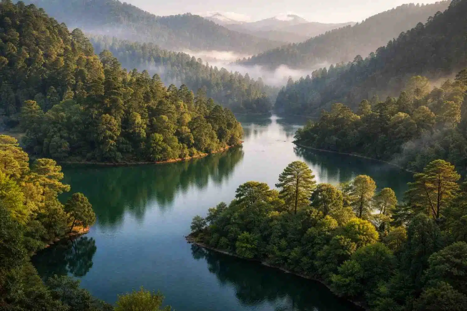
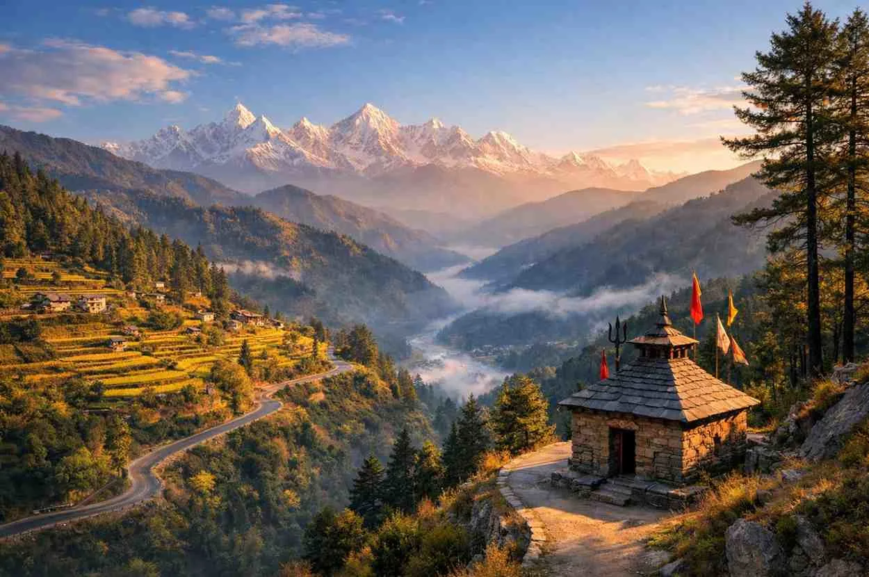
● In the Garhwal Himalayas: The lake rests beneath the dramatic amphitheatre of Trishul and Nanda Ghunti massifs, approached through oak–rhododendron forests and vast alpine meadows called bugyals.
● Roopkund Lake altitude: approx. 5,020 meters (16,470 ft): Most reliable references place the lake just above 5,000 m; it is frozen much of the year and often appears smaller or larger depending on snowmelt.
● Part of the Nanda Devi Biosphere Reserve: The Roopkund trail and surrounding meadows fall within the wider Nanda Devi Biosphere Reserve landscape (a UNESCO-recognized reserve with core and buffer zones), which is why environmental regulations are stringent.
Quick orientation for trekkers:
Usual access is via the roadhead at Lohajung (also spelled Lohargunj/Lohajang). From there, multiple on-foot approaches converge via Wan or Didna villages, leading up to the celebrated meadows of Ali Bugyal and Bedni Bugyal, and onward over high camps like Pathar Nachauni and Bhagwabasa to the lake’s rim.
Why Is Roopkund Lake Called Skeleton Lake?
Key Reasons:
● Hundreds of visible human skeletons around the lake: When seasonal snow and ice recede, skeletal remains are visible in and around the waterline.
● Skeletons date back to the 9th century CE (as per studies): Early investigations pointed to a group that died roughly around 800 CE.
● Likely caused by a sudden natural disaster (hailstorm theory): Based on cranial injuries and local legend, a now-famous hypothesis suggested a violent hailstorm that killed a traveling group during a pilgrimage.
● Skeletons become visible when ice melts: In late summer/autumn (depending on weather), the lake thaws partially and reveals human bones, artifacts, and wooden items along the edges.
Important context: Newer genetic work has complicated the simple “one-event hailstorm” explanation (see next section). What’s certain is that Roopkund sits at an extreme, storm-prone altitude and preserves remains unusually well due to cold, arid conditions.
Mystery of Roopkund Lake (Scientific & Historical Insights)
Roopkund’s enigma isn’t just the presence of bones—it’s who these people were and when they died. Over the decades, scholars floated theories: a lost army, a royal procession punished by the goddess Nanda Devi, traders caught in a freak storm, or pilgrims overwhelmed by weather. Scientific methods have since added surprising detail.
● DNA studies suggest multiple groups of people: A landmark 2019 study analyzed genome-wide ancient DNA from dozens of skeletons and found three distinct ancestry clusters—one South Asian group and another with eastern Mediterranean-like ancestry, indicating that Roopkund’s dead do not all belong to a single local event.
● Some skeletons linked to ancient pilgrims: Ethnographic references to the Nanda Devi Raj Jat pilgrimage, finds as parasol remains, and regional folklore still make a pilgrimage-related origin plausible for at least a subset of individuals.
● Harsh weather and geography explain preservation: Cold, thin air, and frequent freeze–thaw cycles keep the lake frozen for much of the year; exposure periods are brief, which preserves bones and sometimes tissue.
● Still one of India’s biggest mysteries: Radiocarbon data reveal different time windows of death—some individuals around ~800 CE, others far later (even ~19th century). The Mediterranean signal shocked researchers and remains under debate regarding how/why those people reached this remote basin.
Bottom line: The once-dominant “single hailstorm” narrative explains one event plausibly, but Roopkund likely hosted multiple, separate tragedies across centuries—some local, some unexpectedly cosmopolitan.
Roopkund Trek Route & Itinerary Overview
Common Trek Route (classic approach):
1. Lohajung (Base Camp):
A small, friendly settlement and staging point (~7,000–7,600 ft). It has basic guesthouses, last-minute supplies, and the forest department office for permits.
2. Didna / Wan Village:
Both are traditional villages; Wan has a revered old deodar temple and is often used to shorten day one via a jeep ride from Lohajung. Didna is the gentler acclimatization alternative with a steeper final climb after the Neel Ganga bridge.
3. Ali Bugyal & Bedni Bugyal:
Among India’s largest alpine meadows, famed for sweeping, undulating grasslands and big views of Trishul and Nanda Ghunti. Bedni Kund (Vaitarani) is a small sacred lake dotted with flags and shrines. The meadows were once popular for camping; new regulations now restrict overnight camping in bugyals (see “Permits & Current Status”).
4. Pathar Nachauni:
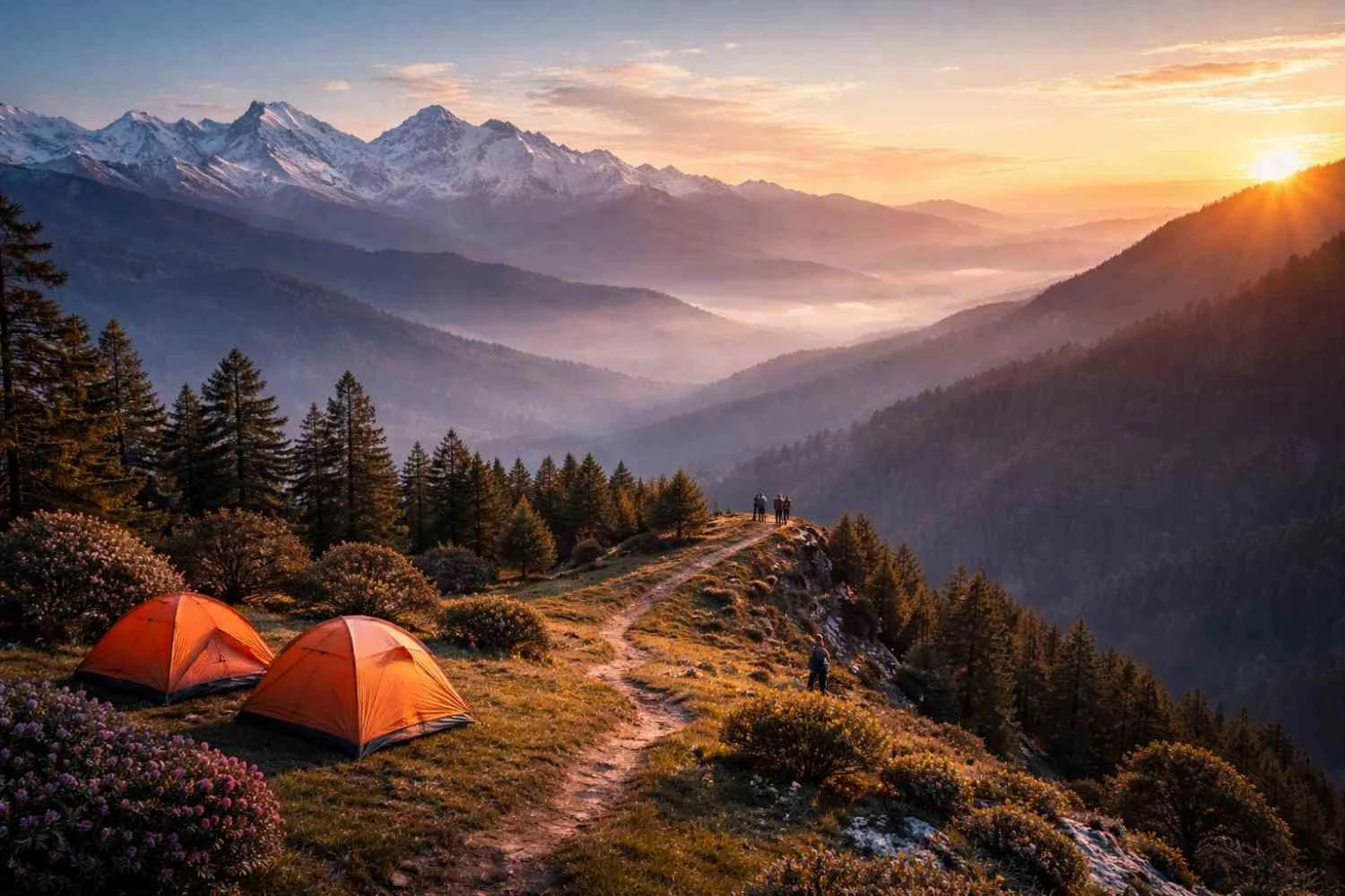
A windswept shoulder that acclimatizes you to altitude. Weather turns quickly; keep shells handy.
5. Bhagwabasa:
Last common high camp amid boulder fields. From here, trekkers make the pre-dawn push towards the lake.
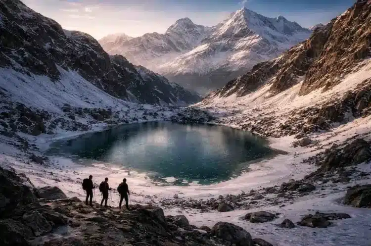
6. Roopkund Lake:
A steep, breath-stealing final climb over snow or scree (conditions vary), ending at the rim of the legendary tarn.
Why this route is special:
You get a complete Himalaya sampler—quaint villages, oak–rhododendron forest, enormous grassy meadows, high boulder fields, and finally a stark glacial cirque.
Trek Distance, Duration & Difficulty
● Total distance: ~53 km (round trip) on the classic multi-day circuit, give or take based on your exact start point (Wan vs Didna vs full walk from Lohajung).
● Duration: 7–9 days excluding travel to the base, allowing for a steady pace and acclimatization.
● Difficulty level: Moderate to Difficult. Altitude, weather volatility, and a steep summit morning make it more demanding than popular low-altitude treks.
● Suitable for experienced trekkers: First-timers in good shape can do it with a professional operator, but winter or late-spring conditions, fresh snow, or storms can escalate difficulty dramatically.
Fitness baseline:
Train for long hill days: 8–12 km with ascents (700–1,000 m gain), back-to-back. Add cardio (runs, stair climbs) and leg strength (lunges, step-ups). Practice with a 6–8 kg pack.
Best Time to Do Roopkund Trek
1. Summer (May to June)
● Clear views: Peaks show up crisp, though early-season storms can still surprise.
● Snow patches remain: Expect snowfields near Bhagwabasa and above; microspikes/traction may be needed depending on the year.
2. Autumn (September to October)
● Best visibility: Monsoon dust is washed away; skies can be pristine, and night photography at camps is superb.
● Stable weather: Generally fewer thunderstorms than pre-monsoon, though high winds and sudden cold snaps are always possible.
Note: The “best time” is also the busiest time. To protect meadows and the alpine zone, expect strict caps, designated camps, and enforcement (see “Permits & Current Trek Status”).
Weather & Temperature During Roopkund Trek
● Day temperature: 5°C – 15°C at high camps in season (lower in shoulder months).
● Night temperature: −5°C to −10°C common near Bhagwabasa and above; wind chill can be worse.
● Sudden snowfall possible: Even late May/early June and late September can receive surprise snow. Carry a proper waterproof–windproof shell, warm layers, and protect electronics from condensation.
Acclimatization rule of thumb:
Don’t sleep more than 300–500 m higher each night once above 3,000 m, and build in a buffer day in case weather forces you down or delays the summit push.
Also Read: Sattal – Cluster of Seven Lakes in Uttarakhand (Complete Travel Guide) HomeTourism
Permits, Rules & Current Trek Status
● Trek is restricted at times for environmental protection: In August 2018, the Uttarakhand High Court ordered a halt on overnight camping on alpine meadows (bugyals) across the state to protect fragile grasslands. Since the classic Roopkund itinerary relied on Ali & Bedni Bugyal camping, this ruling significantly altered how, or whether, the trek is run in its traditional form.
● Permissions required from forest authorities: The trail lies within the Nanda Devi Biosphere Reserve landscape; you must follow current forest regulations, take only approved campsites (typically outside alpine meadows), and carry out all waste. Local range offices provide the latest guidance and permit requirements.
● Check the latest guidelines before planning: Implementation and specific routes/camps have evolved since 2018. Some operators now run modified itineraries with bugyal day-hikes and overnight halts at forest-approved sites below the meadows, or focus on neighboring trails less affected by the ban. Confirm on-ground status with reputable, certified operators and the forest department before you commit.
Responsible practice: The skeletons are an archaeological and anthropological heritage. Do not touch, move, or collect bones or artifacts. Authorities have recorded losses due to souvenir collection; this harms research and is illegal.
Is Roopkund Trek Worth It?
For the right trekker—absolutely.
You’ll get:
● A mystery-laden destination: A glacial tarn fringed with human history and unanswered questions.
● High-altitude Himalayan challenge: The summit morning is steep and exposed, rewarding you with an amphitheatre of rock and ice.
● Alpine meadows and glacial cirques: Ali–Bedni Bugyal remain two of India’s most sublime meadows—now protected more carefully.
● A living link between history and science: Few trails weave together folklore, genetics, radiocarbon, and mountain weather quite like Roopkund.
But you should also know:
● Regulatory changes demand flexibility: Expect itinerary tweaks, long bugyal day-hikes instead of meadow camping, and stricter waste and group-size rules.
● Not a fair-weather holiday: Unstable Himalayan weather, cold nights, and altitude make this a trek—not a casual stroll.
● Cultural sensitivity matters: The Nanda Devi Raj Jat pilgrimage route and regional shrines deserve quiet respect; ask before photographing people or ceremonies.
Safety & Preparation Tips for Roopkund Trek
1. Acclimatization & health
● Proper acclimatization is mandatory: Spend time at intermediate heights (Lohajung/Wan/Didna, then Bedni/Pathar Nachauni) before the final push. Build at least one buffer day into the plan.
● Watch for AMS: Headache, nausea, dizziness, poor sleep, loss of appetite—do not ignore. If symptoms worsen, descend. Carry Diamox (acetazolamide) only on a doctor’s advice; it’s preventive, not a cure.
● Hydration & nutrition: 3–4 liters of fluid a day at altitude; steady snacks to keep energy up. Warm soups help on cold nights.
2. Gear
● Carry cold-weather trekking gear:
○ Waterproof–windproof shell (jacket & pants)
○ Fleece/down mid-layer, thermal base
○ Warm hat, neck gaiter, liner gloves + insulated gloves
○ Trekking boots (broken-in), microspikes (season-dependent), gaiters
○ Sunglasses (UV 400), sunscreen (SPF 50+), lip balm
○ Headlamp with spare batteries, power bank
○ Personal first-aid kit (painkiller, blister care, ORS, anti-nausea, AMS sheet)
○ 40–55L backpack + rain cover; dry bags for camera/phone
3. Team & operator
● Hire certified trek operators: Choose those who limit group size, follow Leave No Trace, carry oxygen and a portable hyperbaric bag (for operators at this altitude), and train staff in Wilderness First Aid.
● Ask about their compliance: Where are the designated night halts? How is waste handled? What is the protocol if Bugyal camping is off-limits during your dates?
4. Trail conduct
● Stay on trail: Shortcuts erode slopes and damage meadow roots.
● No littering, no plastic left behind: Pack out everything.
● Wildlife & heritage respect: No drones around wildlife or shrines without explicit permission; never disturb remains near the lake.
Roopkund Trek: Day-by-Day (Typical, Regulation-Sensitive Version)
This outline reflects the classic feel while acknowledging that meadow camping has faced restrictions since 2018. Treat it as a planning template and verify permitted night halts locally.
Day 1 – Arrive Lohajung (~2,100–2,300 m)
Settle in, gear check, permits briefing. Short acclimatization walk to nearby viewpoints. Nights can be chilly even here.
Day 2 – Lohajung → Didna (or drive to Wan and trek onward)
Descend to Neel Ganga bridge and climb to Didna village through oak–rhododendron. If you choose Wan, you’ll likely climb via the revered Latu Devta temple path. Both options are great for warm-up conditioning.
Day 3 – Didna/Wan → Ali Bugyal → Bedni Bugyal (day-hike circuit; night at an approved lower campsite)
Your first big meadow day. Ali Bugyal’s undulating turf feels endless, with Trishul peeking in and out. Roam to Bedni Kund and down to your night halt outside the meadow boundaries if camping in bugyals is restricted at the time of your visit.
Day 4 – Move to Pathar Nachauni (or permitted alternative)
Climb steadily above timberline. Expect stronger winds. Keep layers handy and drink often. If regulations require, night halts may be positioned just before/after Pathar Nachauni to keep bugyals undisturbed.
Day 5 – Pathar Nachauni → Kalu Vinayak → Bhagwabasa
Steep zigzags to the Kalu Vinayak shrine—a fine acclimatization stop with grand views—then a gradual contour to Bhagwabasa among boulder fields.
Day 6 – Summit Push: Bhagwabasa → Roopkund → (optional) Junargali ridge → return
Pre-dawn start with headlamps. Depending on the snow, you’ll use microspikes. The final approach steepens; footwork and rhythm matter. After Lake Darshan, some teams continue briefly towards Junargali (often snowed out)—only if conditions, time, and regulations permit. Descend to Bhagwabasa or lower.
Day 7 – Spare/Buffer Day
Weather and acclimatization contingency. If unused, savor a slow meadow morning or descend earlier.
Day 8 – Return to base
Retrace to Wan/Didna and onward to Lohajung, celebrate safely, and prep for departure.
Culture & Legends Along the Trail
● Nanda Devi & the Raj Jat Yatra: Every 12 years (with smaller, local versions more frequently), the Raj Jat pilgrimage threads across parts of this landscape. Folklore speaks of a royal procession (Raja Jasdhaval and Rani Balampa), divine wrath, and a fatal storm—echoes carried into the hailstorm hypothesis. Respect local shrines, flags, and cairns along the way.
● Bedni Kund rituals: Offerings at Bedni Kund and songs to Nanda Devi reflect a living mountain culture. Move gently, and ask your guide about do’s and don’ts.
Photography & Natural History
Best frames:
● Meadows: Low-angle shots that exaggerate contour lines; place a human subject mid-frame to show scale.
● Bugyal flora: In the right season, look for alpine blooms and the revered Brahm Kamal (state flower of Uttarakhand)—do not pluck.
● Night skies: Autumn nights at high camps can be crystal; a 14–24 mm lens at f/2.8–f/4, 15–20 s, ISO 3200–6400 is a good starting point.
● Lake & cirque: Use leading lines from scree ribs to pull the eye to the lake basin; go wide to capture the rim in context.
Wildlife hints:
High-altitude ungulates (bharal) leave delicate tracks on snow; you might also spot lammergeiers (bearded vultures) or Himalayan griffons circling thermals.
Ethical Travel & Leave No Trace
● Plan ahead: Smaller groups, local guides, and operators who comply with bugyal rules.
● Travel & camp on durable surfaces: Respect meadow restrictions; use existing camps or rocky terrain where allowed.
● Dispose of waste properly: Pack-out is the standard. Carry reusable bottles and personal cutlery.
● Leave what you find: This includes the skeletons—never touch, move, or collect.
● Respect wildlife & culture: Quiet zones near shrines; no drones without permission; no music on the trail.
● Minimize fire impact: No open fires in the alpine; rely on stoves.
What to Pack (Season-Ready)
Clothing:
● Base layers (synthetic/merino), mid-layer (fleece/down), outer shell (waterproof–windproof)
● Trek pants + thermal bottoms (shoulder season)
● 2–3 pairs trekking socks + 1 warm pair for camp
● Beanie, buff/neck gaiter, liner gloves + insulated gloves
Footwear & accessories:
● Waterproof trekking boots (broken-in), microspikes (seasonal), gaiters
● Trekking poles, sunglasses (UV 400), sunscreen SPF 50+, lip balm
● 40–55 L backpack, rain cover, dry bags
Health & safety:
● Personal meds + first-aid: painkiller, blister kit, ORS, anti-diarrheal, antihistamine, altitude fact sheet
● Water purification (filter/drops), 2 bottles or 2–3 L bladder
● Headlamp + spare batteries; power bank
Documents & money:
● Govt ID, permits printouts, cash for rural stretches
Alternatives If Roopkund Is Restricted During Your Dates
If current rules make your preferred version of Roopkund unworkable, consider:
● Kedarkantha (pre-monsoon/post-monsoon): Snow forests, big summit panorama, regulated but widely open.
● Brahmatal: A Roopkund-region trek with alpine lakes and Trishul–Nanda Ghunti views, often used as a winter alternative.
● Kuari Pass (Curzon Trail): Nanda Devi views from a classic Garhwal ridge line.
● Dayara Bugyal (day-hike focused): Gorgeous meadow spreads; check camping rules—a similar bugyal regime applies.
These give you Garhwal’s feel with less regulatory friction—yet Roopkund’s mystery quotient remains unmatched.
Final Word
The Roopkund Trek is more than a route to a famous lake; it is a corridor through ecosystems, legends, and scientific puzzles. You’ll walk from cedar-scented villages to giant meadows that billow like green oceans, then higher onto austere boulder fields where the air thins and winds sing. At the end lies a small glacial basin whose waters hold stories from different centuries—stories that science continues to revise.
If you go, go prepared: for altitude, for weather, for regulations that put ecology first, and for the humility to treat the lake and its remains as a heritage site, not a trophy. Do that—and you’ll return not just with a summit photo, but with a richer sense of how myth, climate, and human movement can converge in a single, unforgettable hollow in the Himalaya.
Frequently Asked Questions About Roopkund Trek
Because the lake and its immediate shore have hundreds of human skeletal remains that become visible when the ice recedes, leading to decades of research and folklore about who these people were and how they died. Early research suggested a hailstorm around ~800 CE; newer genetic work shows multiple groups and time windows, so the story is more complex.
It depends on current regulations and seasonal conditions. Since August 2018, overnight camping on alpine meadows (bugyals) across Uttarakhand has been prohibited by court order, significantly impacting the classic Roopkund itinerary (which relied on Ali–Bedni Bugyal camps). Many operators now design modified routes with permitted camps below meadows or may avoid the trail in certain months. Always verify the latest rules with the forest department and your trek operator before booking.
Approximately 5,020 m (16,470 ft)—the lake is a small glacial tarn that stays frozen much of the year.
Moderate to Difficult. It demands sound fitness, comfort with back-to-back hill days, and the ability to operate safely in cold, windy, and sometimes snowy conditions. The summit morning from Bhagwabasa to the lake is steep and can be icy.
Estimates vary (often cited 300–800). Not all are visible at once. Some have been lost to theft and disturbance over the years, which is why strict conservation and visitor ethics are emphasized.